Categories
General

Eastbound and Down, and Around

The 1980s were a great time to be a kid.  Sure, we didn’t have iPhones or XBoxes or Legos you can control by computer. We certainly had other electronic devices to keep us amused.  I know, I know, we had the Atari 2600. However, I’m not referring to anything that required a connection to a TV. I’m talking about a toy where you could take control of an 18-wheeler and head eastbound and down, and around, and around.

Slot cars were a popular pastime in the late 1970s and early 1980s.  Much like a model railroad, the vehicles were likewise powered by electricity from the tracks they rode upon.  Just as a model railroad looks like the real-world version, similarly the slot cars use a plastic track that looks like a highway with small wires embedded into it to power the cars.  As slot cars became increasingly popular, TYCO (not the international conglomerate whose CEO ran it into the ground in the early part of the 21st Century, but rather the Mattel division) introduced the HO-scale US 1 Electric Trucking line.

It was a twist on the typical slot car racetrack. Instead of two cars racing side-by-side, you “drove” vehicles in opposing directions on a track that looked like a road.  Now I know what you are going to say, “I already experience the nightmare that is Roosevelt Boulevard, why would I want to when I am home?”  The only similarity the little plastic roadway shared with its concrete and asphalt cousin was the designation.

Much like HO-scale train sets have different themes, so did US 1 for anyone to go eastbound and down.

  • Big City Trucking
  • Big Hauler Trucking
  • City Hauler Trucking
  • Cross Country Trucking
  • Long Haul Trucking
  • Coast-to-Coast Trucking
  • Motor City
  • Interstate Delivery
  • Interstate Trucking

Each set had various “exits” for dump yards, terminals, and material loaders to name a few.

In addition, there was an Army Transport set, a nod to the Dwight D. Eisenhower National System of Interstate and Defense Highways. Furthermore, those trucks hauled crates of ammunition and drums of, no doubt, some classified substances.  At least a decade before the word “intermodal” came into existence, US 1 was already there with an airport and a combination rail and road set.  Consequently, the latter was a little dangerous for US 1 drivers as the rail crossings were at grade without warning signals.

Rather than buying all the sets, it was possible to buy individual accessories like the auto loader from the Motor City set or the fire station from the Fire Alert set.  Besides other trucks and various trailers, additional vehicles were available to customize your layout.  It was possible to buy an Airport Taxi to travel to the airport or a fire engine to sit at the ready in your fire station.

One of the presents my parents gave me for Christmas in 1984 was the Highway Construction set.  I remember walking into the Family Room that early morning and seeing what looked like a little roadway set up near the fireplace.  It was a toy that entertained me as a young road enthusiast.  It was a great and fun toy, and a shame that TYCO stopped manufacturing the line in 1986.  To sum up, one of these days, I need to make an “archeological dig” in my parent’s basement to find all the pieces. Then I can take a trip down memory lane, eastbound and down, via a small slot truck.
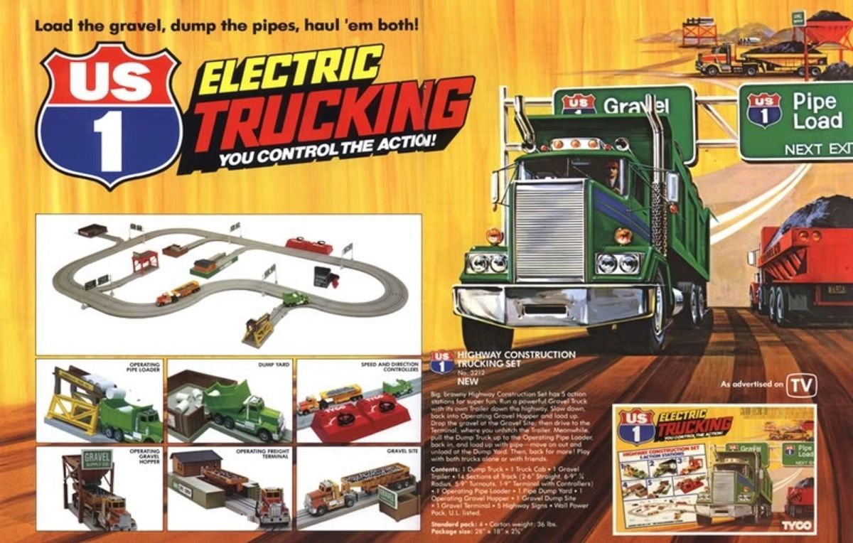
The US 1 Highway Construction Trucking Set where you could go eastbound and down via a small slot truck
The US 1 Highway Construction Trucking Set

TYCO US-1 Trucking Resource

Share this:
Categories
General

HOV Lanes Inaugural Trip

OK, so it has taken a little over 20 years to drive the only HOV lanes in Pennsylvania, but who’s counting?  There are many reasons why I’ve never driven them to this point. The biggest reason being is I’ve only lived east or south of Pittsburgh. So it didn’t make sense to utilize them when taking the Parkway North.  That was until today. After a quick stop in Shadyside, I continued on my journey north to Ross Park Mall.

The lanes comprise the third Port Authority of Allegheny County busway, built as part of Interstate 279 and Interstate 579. However, personal vehicles are permitted to use this busway unlike the other three.  They are HOV+2 and inbound one-way for the morning rush and outbound one-way for the evening rush and weekends.

The Trip
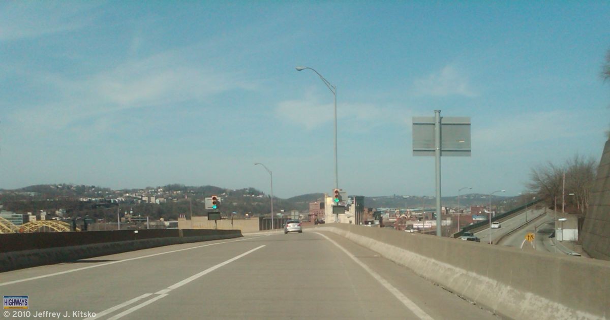
Crossing over PA 380/Bigelow Boulevard just after entering the HOV lanes at Bedford Avenue.
The entrance at Bedford Street near the Mellon Arena leads down a long ramp that is initially two lanes as it crosses PA 380/Bigelow Boulevard; however, it narrows to one to cross the Veterans Bridge. Of course, when reversed, it’s one lane that widens into two.
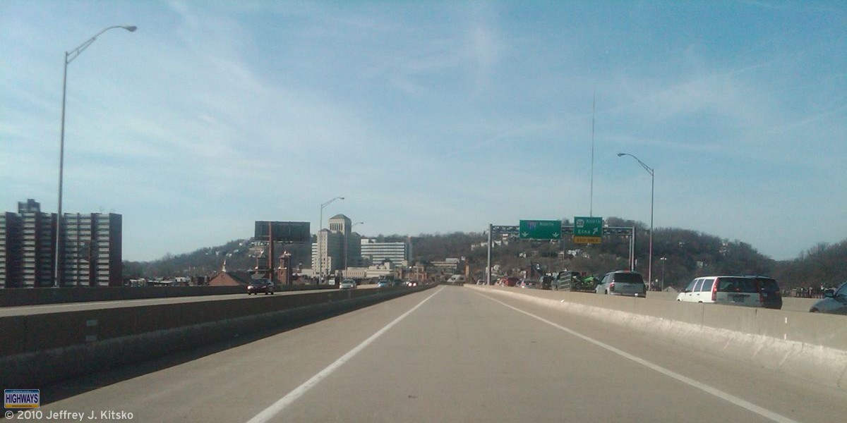
Crossing the Veterans Bridge and approaching the Interstate 279 and PA 28 interchange.
Crossing the Allegheny River on Veterans Bridge on State Route 6579 which is the PennDOT inventory designation for the HOV lane on Interstate 579.
Passing through the East Street Valley of Pittsburgh.
In the East Street Valley, where the other lone HOV lane from the North Shore joins the one from Interstate 579 to create a two-lane roadway designated by PennDOT as State Route 6279.  It’s like the First Class section of the Parkway North!
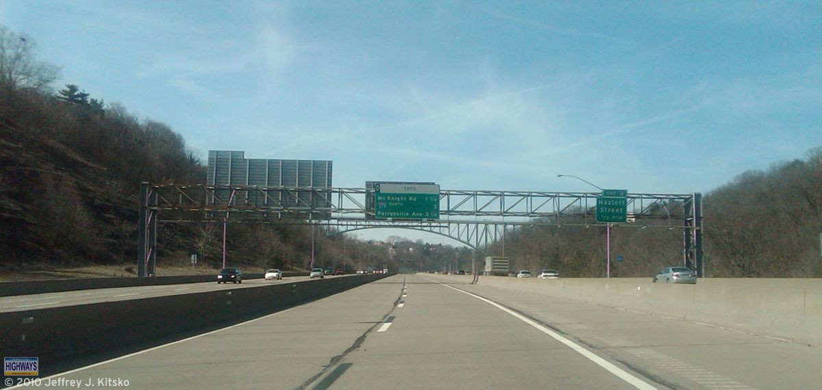
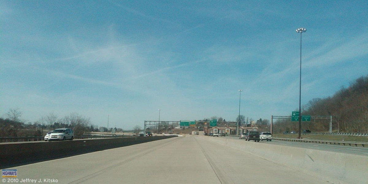
Approaching the McKnight Road interchange.
Approaching the McKnight Road interchange in the North Hills of Pittsburgh. Just as at the I-279/PA 28 interchange south on the North Side, the lanes split here as well. One exits to McKnight Road, while the other continues north to Perrysville Avenue and eventually to merge into the mainline.

For more on the lanes, check out the North Hills Busway/North Hills Expressway HOV Lanes page over at Pittsburgh Highways.

Share this:
Categories
General

Pennsylvania Highways v0.1

Let me tell you kids about the good ol’ days, as some folks like to call them. Human knowledge would be put into “books,” which are like websites. These “books” were similar to a Kindle, iPad, or Slate, but consisted of “paper” rather than microchips. They also did not need recharging every other day, nor a Wi-Fi or cellular connection. Even back in these “analog” days, there was a Pennsylvania Highways presence.

In this simpler time, a “superhighway” consisted of asphalt and concrete rather than fiber optics and servers. These roads would connect the farthest reaches of the country with the other farthest reaches.  In the early days of the highway system, there were no signs nor maps. Forget about GPS devices! They wouldn’t be available at the local Sears, Roebuck and Company for about another eight decades.

Associations formed around the United States to solve the problems that early travelers faced on unmarked and unnumbered trails. In this early period of road travel, names marked highways rather than numbers. Two of the more notable ones were the Lincoln Highway and the Yellowstone Trail.

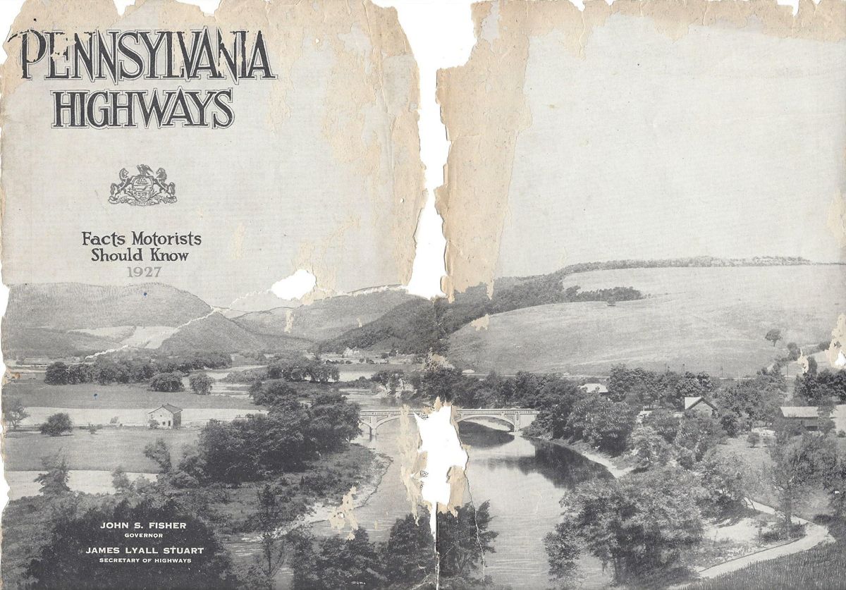
States saw what these groups were doing and decided to take matters into their own hands. They began marking those routes by numbers rather than names.  Pennsylvania was one of the first to number main highways in 1925. It was also the first to assign a single designation to cross-state routes.  To spread the world to the traveling public about these routes and help tourism across the Commonwealth, PennDOT’s predecessor the Department of Highways published the booklet Pennsylvania Highways: Facts Motorists Should Know in 1927.

Cover of the booklet entitled Pennsylvania Highways from 1927.
Pennsylvania Highways circa 1927

I did not know about this booklet when I named the website, which was originally entitled Pennsylvania Highways and Byways.  My uncle discovered this rare gem on eBay. He gave it to me as a birthday gift, roughly 80 years after it was printed. The North-South Parkway, or the “New 48” as it was referred to, would have cut through where he lives had it been built.

The booklet begins with a message about being the keystone of the highway system from Governor John S. Fisher and one about the highway program from Secretary of Highways, James Lyall Stuart.  Further articles talked about the Pennsylvania Highway Patrol (State Police) and how motorists benefit from maintenance from the Department of Highways Chief Engineer. There is even one on the highways of Pennsylvania from the perspective of a woman.  One article that stood out was from the President of the Pennsylvania Motor [AAA] Federation Richard C. Haldeman, who proclaimed in the title, “Pennsylvania Has the Best Highway System in America.”

Much like the modern version, the booklet contains descriptions of routes under the State’s jurisdiction, as well as pictures from various points along them. The following is a list of the state routes which existed at the time of publication:

  • 1 – Lincoln Highway
  • 2 – Lackawanna Trail
  • 3 – William Penn Highway
  • 4 – Susquehanna Trail
  • 5 – Lakes to Sea Highway
  • 6 – Old Monument Trail
  • 7 – Roosevelt Highway
  • 8 – William Flinn Highway
  • 9 – Yellowstone Trail
  • 10 – Buffalo-Pittsburgh Highway
  • 11 – National Pike
  • 12 – Baltimore Pike
  • 13 – Harrisburg to Maryland State Line via Carlisle
  • 17 – Benjamin Franklin Highway
  • 19 – Lewistown to Narrowsburg, via Wilkes-Barre and Scranton
  • 24 – Harrisburg to the Maryland Line, through Gettysburg and Emmittsburg
  • 41 – Harrisburg to Lancaster
  • 44 – Buchanan Trail
  • 64 – From State Line, North of Cumberland, Maryland to Susquehanna Trail, South of Lawrenceville
  • 88 – Perry Highway

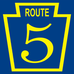
A map section in the middle of the booklet shows these primary routes, as well as others signed at the time. At this time, route markers were gold on blue rather than the black on white we know today. During this era, telephone or telegraph poles would have route markers painted on them. The map section for the central part of the state made mention of this practice.

Original state route shield that were usually painted on telephone or telegraph poles.

Included is an explanation of “DETOUR” and “TEMPORARY” routes. This was important since the highway system was still very much a work in progress. Depictions of various signs that one would find along the roadways of the Commonwealth peppered the booklet. This was to let motorists what they’d find to help them navigate the still burgeoning highway system.  What I find interesting are the signs for things such as speed limits and passing zones. They were the same shape as the keystone markers which greeted travelers at the entrances to towns.

Of course, there were no Interstates nor toll roads, or even US routes for that matter. The map section contains the following explanation for those missing routes:

The numbers assigned transcontinental highways by the Joint Board named by the Secretary of Agriculture will not be used on Pennsylvania Highways in 1927. Until a final decision has been made on all routes and the decision is accepted by the Pennsylvania Department of Highways, the markings will not be found on Pennsylvania highways or officially recognized by the Pennsylvania Department of Highways.

I guess that decision came quickly because US routes would appear on the 1928 Department of Highways map.

The tourism section provided pieces on historic sights listed by county.  Specific ones such as Lake Erie and President James Buchanan’s birthplace are written about in greater depth.  Listings of state parks and tourist camp sites were provided for those who wanted to enjoy the great outdoors.  Directions between cities were provided by either traveling one direct route or several alternate routes. The mention of road improvements that had taken place are under the respective route descriptions. Directions are also provided to out-of-state places such as New England and Florida!

Tenjamin G. Eynon, Registrar of Motor Vehicles, wrote the final section of the booklet. He explained the function of his department as well as providing information on titles, plates, required equipment for cars, and rules of the road. The last page has a list with pictures of flowers found along Pennsylvania’s highways, as well as rules on picking them.

It is always interesting to find gems like this which detail transportation in a long-ago era.  The more things change, the more they stay the same, it seems.  Next up, kids: I will tell you a fantastic story of when MTV played music videos. If there is time, I’ll tell one about when The Weather Channel broadcast weather reports!

Share this:
Categories
General

Roads on Television

I’ve always had an interest in broadcasting. It began by building a small AM radio station with a Radio Shack 130-in-one Project Kit. Then it extended to college where I studied Communication. So it comes as no surprise my interest in media would overlap with roads.

The advent of digital TV has opened up the world of multicasting to broadcasters. Many are utilizing their new bandwidth for other programming in addition to their main channel.  PBS affiliates are airing other PBS-branded channels such as Create. Other affiliates, such as WQED, have created local channels. Their Neighborhood Channel airs a lot of Rick Sebak’s Pittsburgh documentaries from their library. NBC affiliates are co-branding the NBC Weather Plus channel for their local markets.

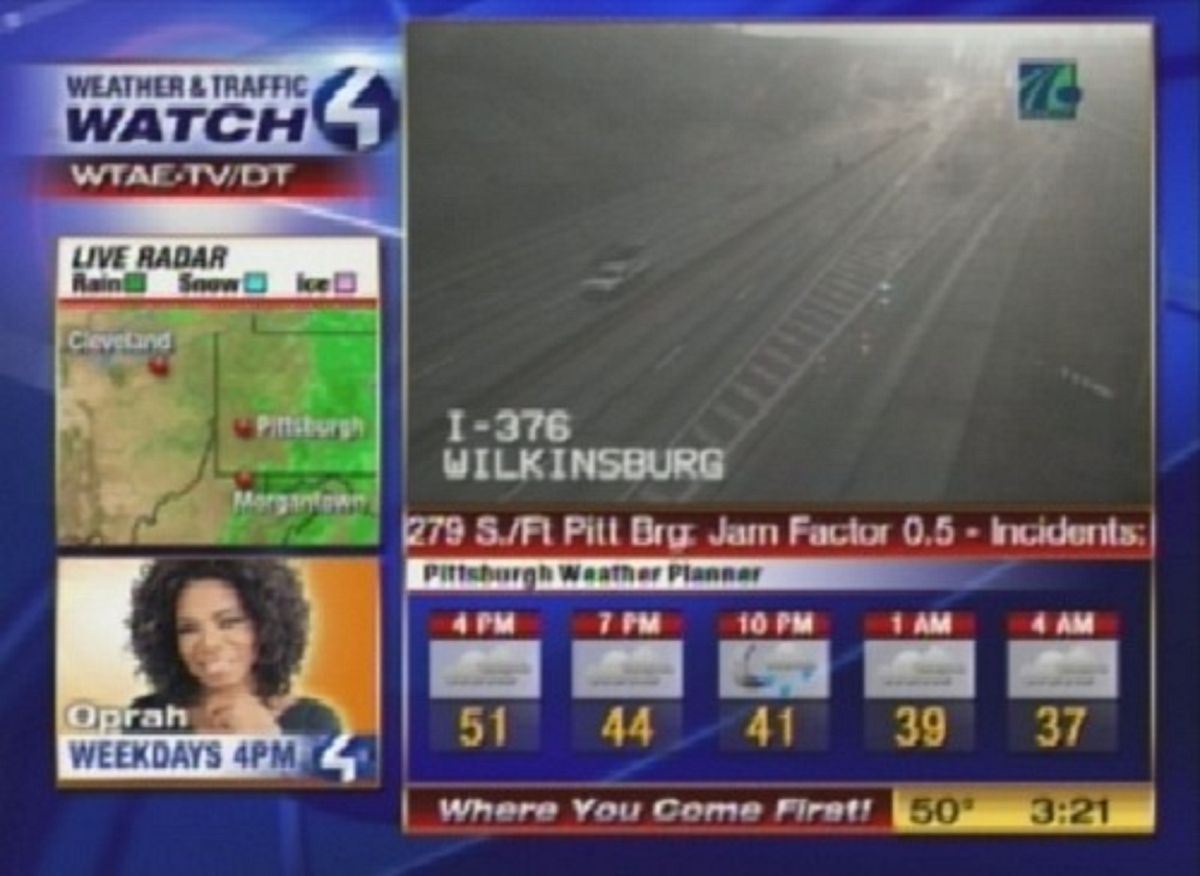
WTAE-TV launched their Weather & Traffic Watch 4 channel in the Spring utilizing AccuWeather content. Since I have an interest in roads as well as weather, this channel sounded like something to check out. Traffic.com information is in a crawl at the bottom of the video portion of the screen. Sometimes video from PennDOT traffic cameras will be shown from various points, such as Interstate 376 seen below.

Screenshot of WTAE-TV's Weather & Traffic Watch 4 channel with roads on television.
WTAE-TV’s Weather & Traffic Watch 4

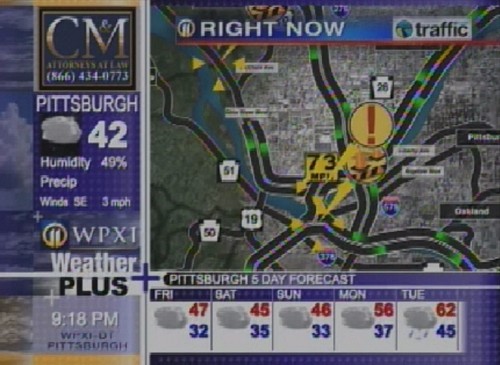
This made WPXI-TV kick it up a notch. They are now providing traffic information during the local inserts on their Weather Plus channel.  The difference is that they use Traffic.com’s flow maps to show traffic conditions instead of a continual text crawl.

Screenshot of WPXI-TV's Weather Plus channel with roads on television.
WPXI Weather Plus

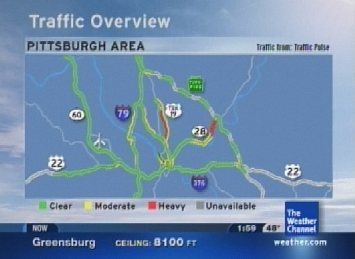
Even The Weather Channel now provides traffic information during their “Local on the 8’s” segment. Sorry DIRECTV and DISH subscribers, but it’s only on cable.

The new IntelliStar systems feed information during those segments on the main channel and all day on their Weatherscan channel.

Screenshot of with roads on television during The Weather Channel's "Local on the 8's" segment.
The Weather Channel

The idea of roads on television is not a new one. San Antonio, Texas has had a low-power TV station owned by TxDOT airing traffic camera feeds since 1996.

Share this:
Categories
General

It’s a Road, Charlie Brown!

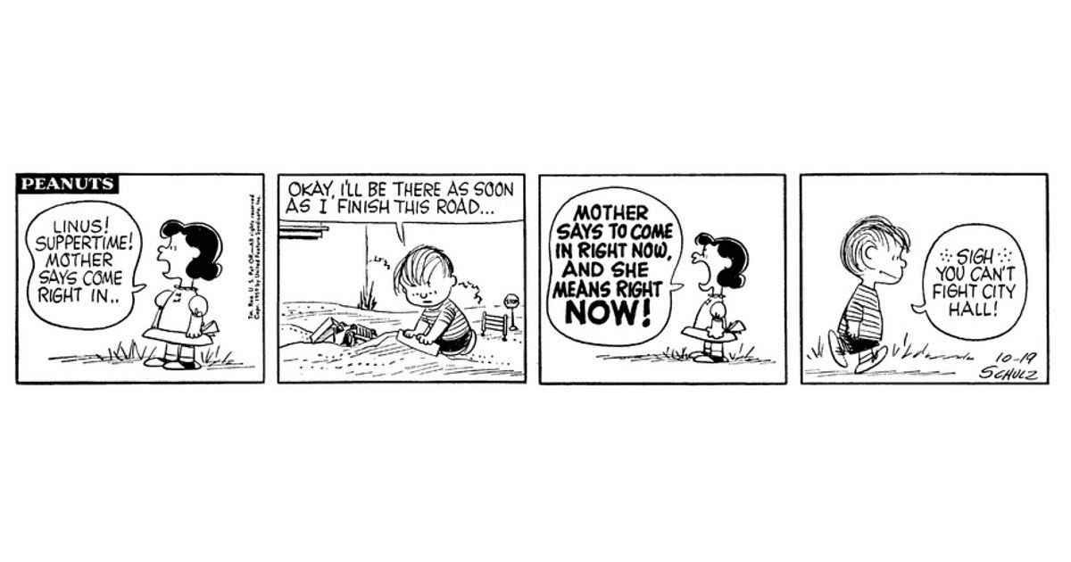
I’ve always enjoyed the comic strip “Peanuts” and the gang, and watching the yearly specials that air around the holidays.  I even had a dog named Snoopy, but he already had that name before my family adopted him. Not to mention, when I was little, he was by my side when I played out in my parents’ backyard. Since Charles Schulz retired from drawing the daily comic strip featuring Charlie Brown and the gang in 2000, I now get a daily Peanuts comic strip via e-mail. So when this one popped into my inbox, it definitely hit close to home. It’s as if it should have been one of the many specials that have been broadcast over the years. Perhaps its title could have been It’s a Road, Charlie Brown. Just throwing it out to see if it sticks!

The strip that arrived in my e-mail today originally appeared in newspapers on October 19, 1959.  Much like most little boys, I liked to play in the dirt with my toy trucks. Either building roads out of mud or repairing mud roads, mimicking what I saw in the real world.

Let me tell you, there was plenty to mimic back in the 1980s in southwestern Pennsylvania. The Penn-Lincoln Parkway reconstruction project was winding down just as construction was beginning on the Parkway North. Then of course there was the usual construction work that took place from year-to-year.

With my interest in roads, I’d usually end up “building” or “repairing” one made of mud. My dog, Snoopy, would usually be the first to use my mud road. You could tell by the definite paw prints in the newly poured roadway.

Linus is playing in the dirt in a strip that could be called "It's a Road, Charlie Brown."

Since it was 1959, I wonder if Linus is “building” one of those new Interstates people were talking about.

Peanuts – GoComics

Share this:
Advertisements